

|
|
|
 |
|
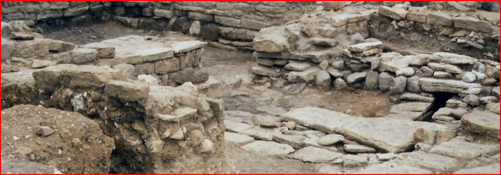
Geophysical surveys are often the crucial stage of fieldwork in establishing the likely presence and the extent of archaeological deposits on a proposed development site. These surveys add an important dimension to our archaeological understanding and enable other fieldwork, such as trial trenching or open area excavation, to be located economically to answer specific questions, while also providing a broader context for that work.
However, geophysical prospection is not always conclusive, because some kinds of archaeological features leave too slight a trace and results can be heavily influenced by the nature of the underlying geology, but it is a valuable and low-cost way of gaining early information on the archaeological potential of many sites. Archaeology and Heritage can undertake a varied and comprehensive programme of non-intrusive geophysical techniques for our clients, which include: Magnetometer Survey Magnetometry measures local variations in the earth’s magnetic field. The magnetic properties of the soil can be changed by activity such as burning, and cut features are sometimes filled by the magnetised soil. This provides the differentiation to the background soil that we can measure. A magnetometry survey will therefore typically detect ditches, large pits, kilns, hearths, ovens, ceramic dumps and occasionally walls. However, modern disturbance will prohibit surveys using a magnetometer as the interference will be too great to detect any archaeological remains beneath the soil. The interpretation of results can often be problematic, especially when determining if an anomaly is geological or archaeological and the technique is very dependent on local soil type and geology for successful results. Resistivity Survey A resistivity survey measures the resistance of the soil to electricity by passing a current through the soil. Walls and rubble will offer high resistance to the electric current, whilst conversely features filled with soil, such as pits and ditches, can offer lower resistance than normal. A resistivity survey can therefore read and map the presence of such features. However, the technique is not without its limitations: it is very dependant on the weather, since very dry or very wet conditions will adversely affect the results; and surveys can be slow with the results difficult to interpret. Most surveys will also require an invasive assessment, such as trial trenching, to assess the results over areas of potential interest. To find out more about our geophysical surveys and how this may help your development, please contact us.
|
All material on this website, including images, text and graphics, is copyright © 2008 Archaeology and Heritage Management Consultancy unless otherwise stated. The material on this site should not be used, copied, stored or transmitted without the prior written consent of Archaeology and Heritage Management Consultancy in accordance with the Copyright, Designs and Patents Act 1988. |


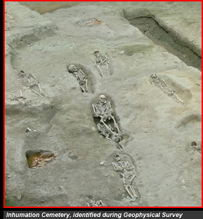 The techniques of geophysical survey are particularly useful in helping to locate features such as ditches and hearths that can then be more fully evaluated by selective investigations. The early identification of the possible location of such archaeological features will improve the archaeologist’s ability to plan a programme of investigation. Better planning leads to more effective research.